Martis Valley Sunrise Fog - June 2016
I've spent seven of the last eight summers working at Soar Truckee, a glider/soaring operation located at the Truckee-Tahoe Airport just north of Lake Tahoe in California. To limit my commuting (my home is an hour away) I frequently spend the night in the Soar Truckee bunkhouse if I work two days back-to-back. I usually wake up around sunrise in the bunkhouse on those days, and always get great photo opportunities, some of which I'd like to share here.
The Truckee airport is located on the floor of the scenic Martis Valley, surrounded by mountains on all sides. Martis Valley is frequently prone to morning fog, due both to its position as a cold air sink, and to its elevation (the airport sits at 5,900 feet, the lowest area in the valley). On the morning of June 19, 2016, I captured some of my favorite photos of the fog when I went for a morning run along the road which leads around the airport perimeter to the gliderport, and continues along to cross a dam which forms the (nowadays mostly dry) Martis Lake reservoir.
I really enjoy these photos because I haven't since had an opportunity to shoot under similar conditions (pine trees, fog, and perfect sunrise lighting).
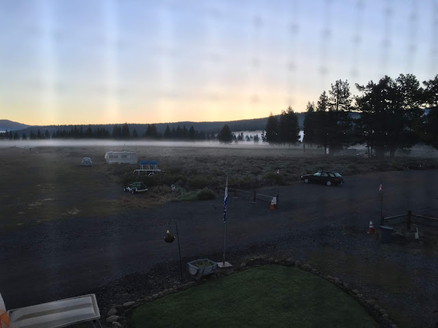
Looking north-northeast at the area on the horizon where the sun is about to come up. Because I took this photo so early in the morning, my car is the only one in the parking lot. I unwisely took the picture right against the screen on the bunkhouse window instead of stepping outside onto the deck (it was pretty cold outside, probably low 40s), so that's a bit distracting.

Fortunately I wised up and took my remaining bunkhouse pictures from outside on the deck. Here, looking north directly after sunrise. On the left are several of the trailers belonging to pilots who have brought their gliders up to Truckee to fly. I don't know if the fog had gotten thicker since I had taken the last photo, or if the sun just accentuates it, but I love the effect.

Taken immediately after the previous photo, looking southwest towards Donner Pass, the (obscured) runways and terminal building, and most of the Soar Truckee fleet: two tow planes, two training gliders, and one of the two ride gliders. The block heater plugged into the white tow plane is indicative of the cold temperatures, even in June.

Getting into the photos I took on my run, I'm starting with my favorite. I was pleasantly surprised that the exposure of the shaded foreground and bright rays of sun permeating the fog are so well-balanced. The iPhone 6S camera does quite a good job!

Looking further down the road leading to the dam. I think the lake was generating a fair bit of the fog in the immediate vicinity of the airport, since it got thicker and thicker the closer I got the the dam.

Looking back from where I've come, I can no longer see the gliderport through the fog.

I couldn't resist including another one of these. I do however like the other one better because the foreground is a little more open and illuminated, and the horizon more clearly defined.

Crossing Martis Dam. As seen in the next picture, the feeling of mystery...

...is heavily influenced by sunlight levels and direct illumination. I think I took this one from the other end of the dam, which was still in the morning shadow of the nearby mountains.

Comments
Post a Comment